Cathodic Protection on Track
GEOMAGIC CP ANALYST: THE MANAGEMENT SYSTEM FOR CATHODIC PROTECTION DATAGEOMAGIC CP Analyst: The Management System for Cathodic Protection Data
CP Analyst, GEOMAGIC’s web-based, geo-collaborative application allows you to integrate, visualize and analyze all your CP-related information from protected structures, inspections and remote monitoring in a single system.
With CP Analyst, you have a clear overview of your CP systems status and your protected assets to ease the planning and documentation of any maintenance required. CP Analyst serves as a data hub to facilitate long-term documentation and to provide evidence of CP compliance.
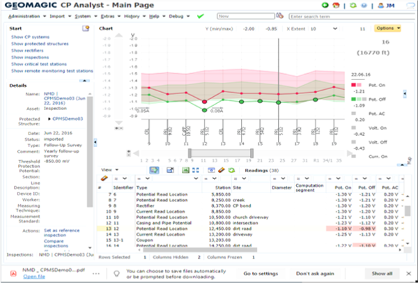
Interactive analytical tools allow for tabular and graphical presentation of detailed inspection results and comparison of successive inspections. In an inspection’s detail view, a map provides information about related test stations and read locations, respectively, in a geographical context.

CP Analyst allows you to define reference value ranges and threshold value ranges for all reading value types and to declare follow-up surveys as reference inspections. Reading values beyond the defined ranges are marked critical, which turns the respective read location into a critical read location.
Additionally, CP Analyst calculates the off potential’s positive threshold from the soil resistivity. For this purpose, bridged insulating devices and interference bonds are considered. Electrically connected parts of the network can then be displayed in the map view. Relationships between assets and CP Systems are presented in a table.
Changes to asset data are stored as versions. Previous versions are archived and remain accessible in CP Analyst for future reference.
BENEFITS AT A GLANCE
One system for all CP-relevant data
Wide range of interfaces: inspection and remote monitoring data, SAP, supply system surveys
Integrated document management
Traceable documentation of all CP data, including historical object versions
Web-based platform, easy IT integration
Optional geographical information with map view
Quick overview with filterable and sortable tables and interactive charts